mmmm... mid March bluebird pow pow

posted by nies
17 Mar, 2015
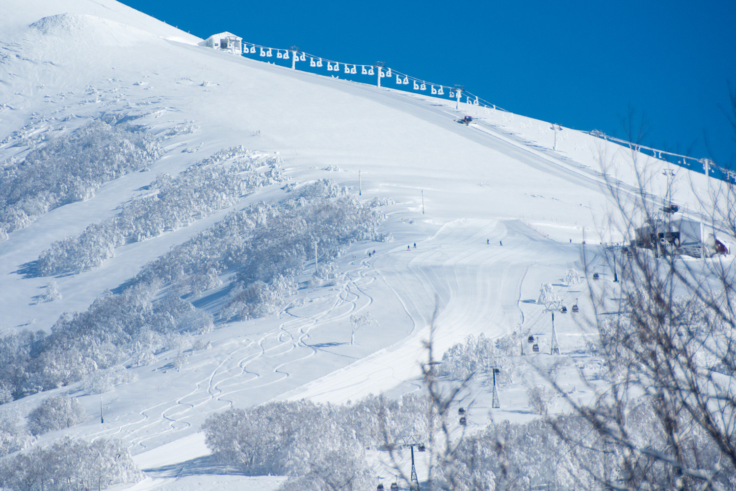
mid March bluebird pow pow, last Saturday , day turned to snowy cloudy sunney day with deep turns to be had everywhere.
mid March bluebird pow pow, last Saturday , day turned to snowy cloudy sunney day with deep turns to be had everywhere.
we've been keeping an eye on Metvew for the last few days, infact we keep an eye on it regulary, the incoming system still looks like it will deliver over the next 24 hours. We have posted the 12 and 18 hour forecasts below issued 9am this morning, Sunday 8th of February.
It's one month since the snow started to fall and settle in Niseko. At our snow measuring station we have recorded 5.33 metres so it has been one great start to the season even if a little late. Last year to date it had snowed 4.94metres in the same spot, so not much in it.
it's been 2 weeks since it started snowing and a total of 259cm has fallen, if you count the 31cm that fell on the weekend of 14th and 15th of November (that melted) we are over 2.9 metres this season thus far.
This has set the mountains up nice and if you compare to last year we are now on track, in fact last season to date we had 263cm.
The last 24 hours things have got a little warm in the valley and it rained but things have just reset and next 24hours are looking good, snowing as we type this.
with 60cm measured up at Goshiki yesterday afternoon and continued snowfall for the last 24hours the upper mountains will now have a good start on the season, with northerly wind flow generated from the systems at present we would say the the snow snow will just keep coming. see our last post (and our why does niseko get so much snow page) for explanations.
it's been a bit of a slow start to winter again this year but looks promising once the next storm passes. Coming from the south it is a bit warm which will bring rainfall with it.. ouch.. but after it passes the wind will come from the west straight off the Asian Continent and with it a nice flow of cold air, snowfall is forecast from Monday next week.
last year on the 15 of November we got first tracks on Annupuri, you can read about that here. This year first tracks were on the 16th but you may have been able to get tracks earlier. When we first looked at the resort at about 8am someone had already be up and ridden down and a couple of new crews were just heading out. We went home and waited as the forecast was saying snow showers in the morning with the weather breaking in the afternoon. We never expected it to get fully clear but decided to leave it until mid-morning.
over the last 2 days in Anuupuri about 20 - 30cm of snow has fallen with the last front passing through, with temperatures rising again most if not all the snow will again melt over the coming days in the valley. The usual cycle of snow and melt continues but temperature remain lower on the upper mountian so maybe that is safe, lets hope that a new frontal system is not far behind the approaching high.
photos are from yesterday looking at Moiwa Ski Field and bottom Osawa or Annupuri Bowl .
the temperature dropped and the snow fell yesterday and continues to snow now to village level.
photos below of Annupuri and Niseko Village and bottom Hirafu.